
Blue mountains trail Maps
Detailed Route Maps
The Blue Mountains Trail is still a route in the making. It has been compiled with the best current information, but the trail route is subject to change. Through the course of hiking the trail, be prepared to encounter challenging terrain with poor trail conditions, including some unmarked cross country sections through forests and densely vegetated riparian areas.
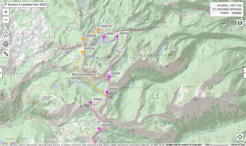
We have compiled detailed hiker maps using Caltopo for the full 530-mile route, as well as additional miles on alternate trails. These maps are meant to be used with an accompanying Databook that indicates trail conditions and known water availability for each waypoint. Examples of these maps are provided below.
To obtain a copy of the Caltopo maps and Databook, please contact Pip Redding at pip@hellscanyon.org. Additional map resources will be added to this page as we make them available.


