
Hike on the BMT:
strawberry
wilderness loop
strawberry wilderness loop - 2-3 days
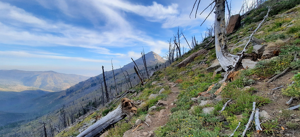
Departing from Strawberry Campground, near John Day and Prairie City, Oregon, this hike takes you into the heart of the Strawberry Mountain Wilderness. The number of trail users quickly dissipates after the short hike to Strawberry Lake. As the trail gains elevation, you'll experience the changing flora found through the Malheur National Forest, camp at pristine high alpine lakes, and enjoy the solitude of this majestic wilderness, headwaters of the South Fork John Day River.

the stats:
Recreation type: 2-3 day backpack
Route type: Loop via Strawberry Campground
Mileage: 16 miles round trip, with options to extend
Duration: 2-3 days
Elevation gain (gross): 4,159 feet
Active time hiking (estimated): 10 hours round trip
Time of year: Early July to end of September
Physical difficulty: Difficult
Logistical difficulty: Easy access, 4WD vehicle recommended
Permits required: Free, self-issued Wilderness permit at the trailhead. Group size limited to 12 people. All other wilderness restrictions apply.
Planning links:
Trailhead access point: Strawberry Campground - USFS link - Google Maps link
Nearby town guide: John Day
Local US Forest Service Office: Malheur National Forest Prairie City Office, 541-820-3800
Trail conditions: Strawberry Mountain Wilderness
Weather forecast at trailhead: National Weather Service
Trip description:
The Strawberry Mountain Wilderness spans its namesake mountain range, overlooking the John Day Valley and the small towns of John Day, Canyon City, and Prairie City. Strawberry Mountain, the highest point of the range, reaches just over 9,000 feet. This trip offers a 2-3 day backpacking loop through the heart of the Strawberry Mountain Wilderness, with an option to extend your hike to the summit of Strawberry Mountain, and visit many of the high alpine lakes with backcountry campsites along the way.
The loop starts and ends at Strawberry Campground, where a short hike leads up to Strawberry Lake. The road to the campground is 10 miles of dusty gravel, washboard and large potholes, so using a vehicle with high clearance is highly recommended. Most campers and hikers do the hike to the lake as a day hike or short overnight backpacking trip. Continuing from the lake, the trail traffic quickly dissipates, and from Strawberry Falls you'll see few people as you continue on the loop. High Lake and Slide Lake have some of the better background campsites in the area. From Slide Lake, you can continue west on the Blue Mountains Trail via the Skyline Trail, which offers more incredible views of the John Day Valley to the north and Bear Valley to the south. With some additional planning, you can set up a shuttle to extend the loop with a hike on the Skyline Trail for an incredible ridge walk to the eastern boundary of the Strawberry Mountain Wilderness.
The Strawberry Mountain Wilderness was designated and protected in by the U.S Congress in 1964. At higher elevations, the area has large stands of threatened whitebark pine, and the area is home to mountain goats, mule deer, black bear, mountain lions and many other species of flora and fauna that rely on the forests, and cold water streams for refuge. Strawberry Campground and Strawberry Lake are experiencing the impacts of overuse, therefore, it is imperative to follow Leave No Track principles, and you can join us in reporting recreation impacts using the Recreation Impacts Monitoring System (RIMS) app (contact us for details and to sign up or download the app and get started).
maps and elevation profile:


Before and After in John Day
John Day, Oregon is a farming, ranching and logging community at the heart of Grant County in Eastern Oregon. It is also is the southern terminus for the Blue Mountains Trail. John Day is a full-service town with grocery stores, laundromat, restaurants, and lodging. It is compact and all services are within walking distance.
While in John Day, you can pick up food at one of three grocery stores or eat at one of a few nice restaurants. 1188 Brewing is popular with both locals and visitors. There are three motels and a nearby campground offering multiple options for an overnight stay.
Be sure to visit local attractions celebrating the town's history from the gold mining era. We highly recommend a free tour of the Kam Wah Chung State Heritage Site, operated by Oregon State Parks. It is a well-preserved former medical clinic, general store, community center, and residence that was originally constructed in 1865 when John Day had one of the largest Chinese communities in the United States.
The smaller community of Prairie City lies 13 miles east of John Day along Highway 26. The road to the scenic Strawberry Campground leaves from its downtown, where you will also find the local U.S. Forest Service office. Here you'll find more places to eat, sleep and fill up your gas tank before heading into the mountains.
For a full list of amenities, including grocery stores, where to do your laundry, post offices, public transit options, and more places to eat and stay, check out the Blue Mountains Trail Town Guides for John Day.
